 The UAE Space Agency has announced the National Space Fund, a new Dh3bn ($817m) national investment and development fund for the space sector.
The fund will support new programmes launched to support international and Emirati companies co-operating in leading-edge space sector engineering, sciences and research applications.
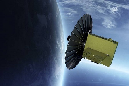
The fund’s first investment will be in the development and launch of a constellation of advanced imaging satellites for the Emirates, using the SAR (Synthetic Aperture Radar) technology. The constellation is to be named Sirb after the Arabic term for a flock of birds, and will address the critical need for better environmental and land usage monitoring, data collection and analysis to meet today’s global challenges.
The planned satellites will be able to create highly detailed and complex radar ‘images’ of land use, ice cover, surface changes and characterisation, with a wide range of scientific, civil and commercial applications.
In a tweet, Sheikh Mohammed bin Rashid Al Maktoum, Vice President, Prime Minister and Ruler of Dubai, wrote: “The UAE today launched Sirb project, the first of its kind to develop a constellation of advanced remote sensing satellites using radar technologies in all weather conditions and can operate around the clock with an accuracy of one metre. The new project aims to develop the UAE’s competitive edge in the space sector and preserve the environment from climate change.”
The fund will also support new national and research strategic projects, and help develop the capabilities of Emirati engineering cadres in space technology.
“We can only contribute to human development by adopting state-of-the-art sciences,” Sheikh Mohammed bin Rashid added.
UAE President Sheikh Mohamed bin Zayed Al Nahyan, tweeted: “The establishment of a dedicated fund to support the UAE’s burgeoning space programme and the launch of a new initiative to develop radar satellites are expected to expand our growing capabilities in this vital sector while accelerating innovation in environmental sustainability.”
Sarah bint Yousef Al Amiri, Minister of State for Public Education and Advanced Technology and Chairwoman of the UAE Space Agency, stated: “A long-term plan and programme for the development of the Emirates’ space sector is in place to create economic opportunities, new jobs and help to fund global partnerships and new leaders in technology, space sciences and engineering here in the UAE. We are planning for a bright future filled with new challenges and openings for our young people – and this fund is precisely targeted at building opportunities for international co-operation in building Emirati enterprises.”
The fund will actively encourage partnerships between international and local enterprises, providing them with incentives as a part of the UAE Space Agency’s Space Economic Zones Programme.
Salem Al Qubaisi, Director General of the UAE Space Agency, noted: “The National Space Fund will encourage global partnerships to establish themselves here in the Emirates, providing new and vital technology platforms and development to answer the needs of the UAE Space Programme and other global customers for vital innovation and technologies that answer the needs and possibilities of today’s world.”
Sarah Al Amiri noted: “SAR technology leapfrogs traditional imaging satellites, providing more powerful imaging using X-band radar technologies, allowing us to continue observations day and night, through fog and cloud cover as well as combining observations to create big data pictures simply not possible through conventional imaging. These small-scale satellites are more agile, faster to develop and more powerful – an indicator of the types of new generation systems that technology is now making possible.”
SAR technology combines the power of imaging satellites with cloud and ground penetrating capabilities that will open up applications from urban planning to archaeology and from weather prediction to atmospheric quality analysis and climate change mapping. Critically, the SAR radar-based technology can provide high-resolution images for remote sensing applications regardless of sunlight illumination and weather conditions.
The six-year satellite development programme will see the first satellite launch in three years, a much faster time to launch than was possible using traditional earth observation satellite design principles. The Sirb satellites will be built through a number of partnerships between the Emirati public and private sector together with international players, with submissions being opened for a range of system integration, development and subsystem construction opportunities as part of the constellation development, launch, operation and commercialisation plan.
As well as addressing critical human needs for more wide-ranging data, the Sirb constellation provides a private sector opportunity that bridges the gap between the Emirates Mars Mission and the upcoming Beyond Mars Mission to Venus and the Main Asteroid Belt, due to launch in 2028.


Add Comment