Bayanat for Mapping & Surveying Services, will outline some of the key products and services that have enabled Abu Dhabi to reportedly mature rapidly as a geospatial technology adopter at the upcoming 2012 Esri Middle East and Africa User Conference (MEAUC).
The conference is the MEA region’s biggest geospatial technology event, gathering thousands of GIS software users and experts, decision makers and business owners annually to discuss solutions impacting the future of the geospatial field in the MEA area
The conference is the MEA region’s biggest geospatial technology event, gathering thousands of GIS software users and experts, decision makers and business owners annually to discuss solutions impacting the future of the geospatial field in the MEA area.
Bayanat has been invited by organiser Esri, a provider of geographic information system (GIS) software and geodatabase management applications, to present key topics at the conference’s latest edition talking place from December 10 – 12, 2012 at the Abu Dhabi National Exhibition Centre (ADNEC).
Bayanat, a Gold Sponsor of the Esri conference, will showcase some of its local and national geospatial initiatives and topographic mapping production projects backed by the UAE’s topographic database, maritime charting for the entire UAE shoreline, and seamless Ortho-Photo production initiative.
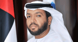
“Abu Dhabi has advanced remarkably in the geospatial domain and has contributed greatly to the UAE’s emergence as a model of spatially-enabled development across the region. Esri’s products, many of which Bayanat has been integrating into its solutions, have been important tools in maximising the use of geographic resources in the emirate and throughout the country. Bayanat has accumulated an extensive collection of techniques and technologies that we continue to deploy for the empowerment of society and that we are eager to share with the global geospatial community,” said Khaled AlMelhi, CEO, Bayanat for Mapping & Surveying Services.


Add Comment