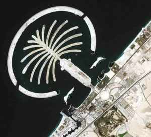
GeoEye, Inc., a source of geospatial information and insight, announced that it signed seven-figure agreements with two international partners in the Middle East and Asia for both the renewal and expanded use of GeoEye imagery products.
The Middle East affiliate has signed a new agreement for access to GeoEye-1 sub half-metre imagery, which is reportedly the highest resolution commercial imagery available globally. This affiliate has had an ongoing agreement with GeoEye for IKONOS satellite imagery collection and distribution since 2000. The agreement with the government customer in Asia renewed their access to GeoEye-1’s imagery products. This customer has had an agreement in place for GeoEye-1 satellite imagery collection since 2009.
Both partners have reportedly indicated they will integrate GeoEye-1’s high-resolution imagery with their own systems to support regional security and peace missions.
“Both the Mideast Regional Affiliate and the Asian government customer have been trusted and valued partners for many years,” said Paolo Colombi, GeoEye’s vice president of International Sales. “We appreciate the extension of our partnerships and the expansion of our global footprint that these agreements represent. We look forward to supporting our partners’ mission critical requirements by delivering superior-quality location intelligence regarding these highly sensitive and dynamic regions of the world.”


Add Comment